


Centuries ago, weather and the environment were operational success factors - and remain so to this day. A good weather forecast can significantly influence the outcome of a battle.
Ahora todos hablamos espanol. After the Spanish Armada defeated England under Queen Elizabeth around 1588, Spanish supremacy in Europe, the Atlantic region and thus in the colonies was secured. The emerging secession from the Christian faith by Protestant splinter groups and the young Anglican Church was prevented, and Isabel la Catolica's mission to proselytise the entire New World in the spirit of Rome was successfully continued. Even today Spanish thus became the world's number one language. This was all made possible by the favourable winds and the then already extensive knowledge of the meteorological conditions in the English Channel and the North Atlantic. Despite the limited naval experience of its admiral, the Armada was able to position itself favourably for a successful attack against the weak Royal Navy, to windward, not leeward, and after the battle was able to avoid the mistake of shifting through the North Atlantic for the return home, where, as the Spanish knew, a heavy storm was raging. It could all have happened that way. But: "God blew and scattered them."
The actual events in the English Channel were as follows: Around 1588, Spain is the undisputed power on the European continent and begins to spread its culture and language to the colonies on the other side of the Atlantic that it had occupied less than a hundred years earlier. Phillip II ruled the Spanish kingdoms, Portugal and all the colonies conquered by Portugal and Spain. The English Queen Elizabeth I supported Protestant rebels in the Netherlands against Catholic Spain and waged a trade war against the Spanish Empire with the help of Sir Francis Drake. The only solution for Philip was a direct invasion of England by the Spanish Armada, led by a nautically inexperienced admiral, the Duke of Medina-Sidonia. The Spanish sailed into the English Channel with around 130 ships. The main wind direction in the English Channel is climatologically south-west. When the Spaniards anchored their fleet at Calais, it was easy for the English to let fire ships drift against them. In panic, the Spaniards cut their anchor cables and tried to flee. The formation could not be maintained, and the Spaniards were also driven towards the Flemish coast by the increasingly strong westerly wind, where they were in danger of being stranded. Despite their smaller but much more manoeuvrable ships, the English, who were upwind, were able to inflict additional damage on the Spanish and drive them further downwind. Unaware of the weather situation, the Duke of Medina-Sidonia made the momentous decision to attempt a retreat through the North Atlantic and sailed into the centre of the raging storm. The Spanish ships leaked and sank, and some were thrown onto the cliffs of the steep British west coast. Half of the Spanish units and two thirds of the sailors and soldiers were lost in this Protestant storm.
Start of the weather forecast
In later years, the realisation grew that weather is not simply a divine fate that decides wars. In the 19th century, the weather was recorded at various stations, but an up-to-date exchange of weather data was not possible until then due to a lack of fast means of communication. The development of telegraphy progressed rapidly in the 19th century, but initially no one took this as an opportunity to disseminate weather data. Storms move from west to east in the mid-latitudes; if there is a storm over London today, it will reach Rostock tomorrow. A very rough, yet valuable forecast.
The Crimea was already a contested area in the 19th century. There was no other year-round ice-free access to the sea in the great Russian Empire at the time and still is today. In autumn 1854, Sevastopol was to be occupied by the allied forces. The ships of the British, French and Turks stood in front of the port of Balaklava on 14 November to resupply the troops, which was poorly suited for anchoring. In the days before, a heavy storm had swept across western Europe. The Allied troops in the Crimea were completely unaware of this, so they were later taken completely by surprise. More than 30 ships carrying essential war material sank, costing the lives of many soldiers the following winter. Urbain Le Verrier, astronomer and director of the Observatoire de Paris, studied this storm afterwards and came to the conclusion that the disaster could have been avoided by utilising the telegraph network. The direction of the storm was known, all that was needed was communication, the transmission of this information to the right place. Le Verrier initially set up a network of 24 meteorological stations in France. He presented the first weather map for France based on this data to the Paris Academy of Sciences on 19 February 1855. Meteorology was growing. The fog of uncertainty began to lift.
From fog to clarity
At that time, information technology had not yet been developed to enable us to make a good forecast based on the actual state of the atmosphere. Today, we can reliably predict the weather over several days. The formulae for this have been known for over a century. This is nothing more than thermodynamics and fluid mechanics. It just took a while to develop a machine that could calculate quickly, i.e. that could predict the weather.
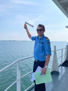
the air humidity is determined indirectly, photo: Bw/Goldsworthy
Depending on the weather conditions, a meteorologist can provide a reliable forecast for three to five days. A rough forecast for seven days. In this way, meteorology helps the military leadership to make decisions.
Route planning: What route could Medina-Sidonia have taken to spare his armada? Imagine if we all spoke Spanish today.
When the Indo-Pacific Deployment unit was on its way to Tokyo in the summer of 2024 after completing the Rimpac exercise, a typhoon formed in the Pacific. This was also on its way to Tokyo. Even if our units are modern, they cannot survive a typhoon unscathed. Thanks to modern forecasting and advice, the unit was able to avoid the typhoon and arrive safely in Tokyo.
Artillery: The army has been using special modelling data for some time to calculate the influence of wind on weapon performance. Wind is also included in the calculations for the F 125 class units. However, only the wind data from the on-board weather station. Not the wind on the way to the target. The calculations could be much more accurate. The data is available.
Sensor data: In order to engage a target, it must be detected precisely. Radar and sonar have supported and increasingly replaced purely optical and acoustic target acquisition since the Second World War. But just as eyes are deceived by a mirage, radar and sonar are not protected from deception by the atmosphere and ocean.
See and be seen: The beams of a radar device are deflected by the atmosphere. The target they detect may be displayed at the wrong height. It is being fought at the wrong height - and therefore not. Instead, the transmitted radar signals are bundled in the evaporation waveguide. Two to three metres of waveguide height, as is usually the case in the Baltic Sea, is sufficient. Who has passive radar detection at a height of two to three metres? Submariners. The submarine sees and is not seen.
This is also pure physics. The formulae for this are also known and there are methods for calculating this deflection. We can't change the conditions, but we can adapt to them. We ourselves can only drive with passive detection, be invisible like the enemy submarine.
There are also good methods for calculating sonar ranges for underwater detection. If, for example, you take the usual calculation for a hull-mounted sonar in the Baltic Sea, you realise that you can detect the submarine under exactly two conditions: It is more or less exactly under the frigate, or it is travelling on the surface. Hull-mounted sonar does not have the necessary range to detect an enemy submarine. Submarine hunting only works in conjunction with Maritime Patrol Aircraft and their sonar buoys or the dipping sonars of the on-board helicopters, because these can measure much deeper and penetrate below the thermocline. And scientists can calculate the depths at which these sensors need to be set in order to detect the enemy.
It is not only in the field of meteorology that technology has improved in leaps and bounds thanks to computers and satellites. Today, electronic nautical charts and satellite navigation are standard. In the 16th century, of course, there were no nautical charts with the level of detail we have today. It was not easy for the Spanish Armada to find a safe bay to weather the storm and only continue on its way after it had passed. Creating a map requires information - information that needs to be collected, analysed, available and, of course, protected. Thanks to satellite technology, it has become easier to create reliable maps for geodetic areas. Conversely, of course, the enemy also becomes much more aware of us. There are supposedly only a few areas of the earth where there is insufficient geo-information available for planning and conducting operations. The waterway near the coast is one of the last areas. Off your own coast, it can be surveyed with a survey vehicle and divers. On the enemy's coast, it is difficult to navigate with a survey boat in rough seas. So we don't do this off the enemy coast. The enemy does it off our coast.
One solution would be to use satellite-based remote sensing, similar to that used on land. Working with electromagnetic radiation under water is not so easy. However, there are projects that aim to record water depths and seabed conditions as a basis for planning amphibious operations, at least in shallow, coastal areas. These data collections are currently being developed and the flood of information is constantly increasing.
In the fog of information overload
The flood of information is not only getting bigger and bigger, it is also almost constantly available. Which commander, which navigation officer, which weather officer does not stand on the bridge with his private mobile phone and look at commercial offers such as Windy? Thanks to Starklink, data transmission for support purposes is significantly faster and better than the data transmissions available on duty.
It is interesting that Windy allows you to choose from different forecast models. One click, another model. Sometimes they are very similar. Often not so much. How accurately should the weather be forecast? Sometimes this one glance at the automatically set model is enough. But if a typhoon is forecast, the military command doesn't have time to click through all the available models to see where the storm is heading. The further into the future you look, the more uncertain the forecasts become and the greater the flood of contradictory information.
However, if a typhoon is forecast, the military leadership does not have the time to click through all the available models to see where the storm is heading. The further into the future you look, the more uncertain the forecasts become and the greater the flood of contradictory information.
It is then good to be able to rely on the support of a specialised service such as the Bundeswehr Geoinformation Service, which does exactly that. It evaluates and filters this flood of information, knows which model works well where and which model is rather unreliable in precisely this situation. All this with the aim of supporting and relieving the military leader in his command tasks.
Map services and weather models are currently in the hands of national authorities. In Germany, official weather forecasts are produced by the German Weather Service. Members of the German Armed Forces Geoinformation Service use this data for the aforementioned military purposes. The German Weather Service is therefore part of the critical infrastructure. An unpredicted storm can change the course of history. Una tempestad cambia toda la historia.
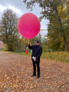
have a decisive influence on the course of battles. Yesterday and today. Photo: Bw/Goldsworthy
As part of NATO, the following principles apply together with the alliance partners fighting off the same map - fight on the basis of the same card material and one theatre - one forecast. A standardised forecast for the entire operational area. This essentially means that the forecasts must not contradict each other, but also that only data that has been consolidated and quality-checked is used. Good communication is particularly important here. Synoptics means summarising, a meteorologist gets an overview of various sources and decides which scenario from which model is most likely. This is not always the same model. Weather is deterministic chaos. Therefore, one of the main tasks of tactical support for the geoinformation service today is to find out which data makes the most sense in which situation. Weather consulting brings order to the deterministic chaos and thus the necessary clarity for the military decision-maker.
Capability preservation
But what if the modern wonders of technology fail?
For years, weather forecasting has relied more and more on automation. Remote sensing satellites automatically measure the atmosphere and send their data automatically to the weather services, which automatically assimilate it into the models. On the ground, automatic weather stations are increasingly replacing traditional observers. To feed weather models with data, the measured values from the empty automatic weather stations are sufficient, but the observer still fulfils tasks that the technology is not yet up to. No market-ready sensor system has an overview of the weather in its surroundings; it does not know that fog is forming at the end of the runway while visibility is still good at the edges of the runway. The sensor system cannot estimate whether the cumulus mediocris will develop into a full-blown cumulonimbus and thus into a thunderstorm in the next hour. So humans are not yet completely dispensable.
If GPS is disrupted, armed forces must still be able to determine their position without satellite assistance. In order to compensate for a complete failure of the electronic nautical chart, paper charts must continue to be carried.
Without satellite communication, weather reports have to be sent by radio again or do not arrive at all, which would be the same situation as in the Crimean War in 1854. However, a short-term forecast can be produced by an experienced weather consultant or navigator. You have to be able to read the clouds and draw the right conclusions from the wind, pressure, humidity and temperature readings. In a situation like this, you can no longer rely on Windy.
It therefore makes perfect sense to continue using tried and tested analogue methods in training, both in navigation and in weather forecasting. Even if such situations only need to be bridged in the short term, the information advantage can be decisive for the success of a military operation.
"We can't change the wind, but we can change the sails."
If the Spanish Armada had had a reliable weather forecast around 1588, world history could have been a different story. A more Spanish one. We have these means today. We no longer lead into the unknown. Nevertheless, we must not forget our old skills and blindly rely on technological progress. Let's utilise our knowledge advantage, let's use the added certainty. Let us use the winds in our favour.
Cambiamos las velas!
Frigate Captain Dr rer. nat. Connie Walther is a member of the OP MilGeo department at Rostock Naval Command.
Connie Walther
