


New algorithm provides unprecedented information for climate research
- An algorithm developed at DLR provides the first high-resolution maps that allow conclusions to be drawn about the current sea ice thickness.
- This is made possible by combining data from the European Sentinel-1 radar satellites with measurements from the ATLAS laser altimeter on board NASA's ICESat-2 satellite.
- The resolution of the generated sea ice maps is 100 metres and exceeds that of the previous maps from compiled measurements by a factor of 250.
- The knowledge gained forms a new basis for environmental and climate science.
- Focal points: Space travel, earth observation, climate research, transport, maritime research
The Arctic is one of the least developed areas on Earth - at the same time, the changes caused by global warming are being felt more clearly here than in any other region. The sea ice cover has been decreasing for years and the existing ice is thinning. The German Aerospace Centre (DLR) has developed a new algorithm that combines radar satellite images from the European Sentinel-1 mission and elevation profile measurements from NASA's ICESat-2 satellite, enabling a high-resolution calculation of ice thickness for the first time. Sea ice plays an important role in the Earth's climate. The white, snow-covered surfaces reflect sunlight into space. Thinner ice appears darker because it is more transparent and allows the seawater to shine through. As a result, thinner ice also reflects less sunlight back into space. It is getting warmer: not only in the Arctic, but everywhere on Earth.
"Certain sea ice properties such as ice concentration or the age of the ice are traditionally read from satellite data and have formed the basis for research into the Earth's climate system for decades. Until now, the ice thickness could not be measured comprehensively from satellite images. Our new algorithm now provides information on ice thickness for the first time, which could significantly improve the navigation of ships in polar waters, for example."
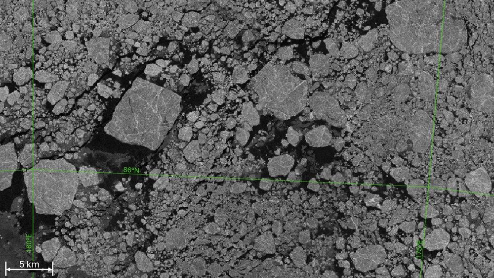
Images from radar satellites show "echoes" of the earth's surface. The satellites transmit a radar signal from their orbits at an altitude of several hundred kilometres, which the earth's surface reflects differently depending on the type of subsurface. The satellite then measures the reflected echoes, analyses them and compiles them into an image that shows the surface of the earth and ice. However, the radar images from space only show the surface composition of the ice, not the ice thickness.
The European radar satellites of the Sentinel-1 mission are travelling in an orbit close to the poles, which allows them to image regions at high latitudes more frequently - some Arctic waters several times a day. This is important because wind and ocean currents are constantly changing the ice. Within a few hours, loose ice floes can be pushed together and close open water areas. If the pressure persists, ice floes pile up on top of and under each other, or they can be raised vertically. The ice ridges formed in this way can become metres thick. However, it is also possible for a closed ice sheet to break up and be removed by opposing forces.
