


The attacks on Iran have an impact on the security of sea routes: why lockdown can be expensive and deadly - and why captains don't care about useless diplomatic recommendations
The USA has bombed Iranian nuclear facilities. A supposedly territorial conflict that appears to have been resolved from the air has a maritime dimension - once again. Not only because cruise missiles were fired from submarines at sea. And so the mullahs are targeting the Strait of Hormuz, which is important for shipping. Meanwhile, the SPIEGEL and HANSA International Journal report that navigation systems on ships in the region are increasingly being disrupted.
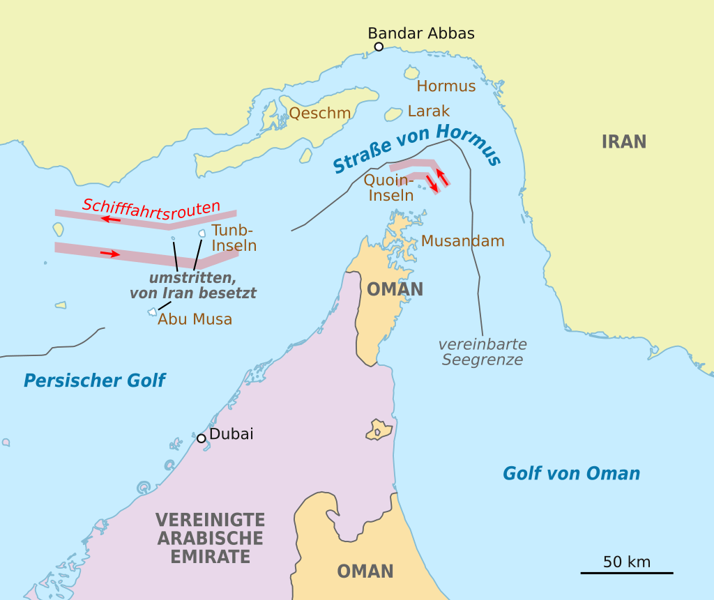
Iran's parliament is calling for this waterway to be closed - once again. The bottleneck to the Arabian Gulf is a so-called Choke PointA closure of the Strait of Hormuz would have a massive impact on international oil trade. However, the Iranian parliament has not yet finalised its decision. The Supreme National Security Council would have to give its approval. In addition, nothing would be possible without the approval of Ali Khamenei, the leader of the Mullah regime. As with all straits, this one is of central economic importance for global oil trade flows and the worldwide energy supply. A significant proportion of the oil trade is channelled through these strategically important passages. The economic consequences of interruptions to sea passages at choke points therefore go far beyond the immediate transport costs.
How important is the Strait of Hormuz?
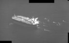
As a result of a lockdown, shipping companies would be forced to switch to other transport routes, and such detours delay transport times and increase transport costs. But since there is no alternative to the Strait of Hormuzinsurance premiums for transits through the region have already risen. Risk surcharges have been added to the first freight contracts. The Strait of Hormuz is only 30 nautical miles wide at its narrowest point. The distance between Iran's Larak Island and Oman's Salama Island is only 20 nautical miles. All shipping traffic to and from the oil ports of Kuwait, Qatar, Bahrain, Iraq, the United Arab Emirates and Iran passes through it, as does the majority of Saudi maritime traffic. The road is the transport area to Asia, Europe and the USA, where around USD 1 billion in value is transported per day and ship. In some years, this adds up to 40% of global oil consumption.
Strait of Hormuz as an ongoing conflict over Iran's nuclear programme
According to the naval forces stationed there, the threat level remains high. If the conflict escalates further, targeted attacks on shipping routes could also follow. With the potential consequences for energy prices, insurance costs and global supply chains, the maritime industry is facing a new phase of geopolitical uncertainty. The coming weeks are likely to show whether the current disruption strategy will remain a targeted means of exerting pressure or whether it will turn into an open confrontation. This is also nothing new in the history of the street. Back in 2006/2007, a US attack on the Islamic Republic of Iran threatened to close the strait due to its nuclear programme. In response, the USA positioned aircraft carriers near the strait. In December 2011, Iran also threatened to close the Strait of Hormuz. In 2014, Iran and Oman developed a plan to provide the Strait of Hormuz with a road link between Iran and the Omani peninsula of Musendem by means of dams and a bridge. Nothing has come of this so far. This time it is different: now the USA has intervened and is no longer just threatening, so one could assume that the mullahs are no longer just threatening either.
Tired reactions
Greece allegedly asked its shipping companies to precisely document all passages through the Strait of Hormuz. However, as every skipper systematically records their routes anyway and a "logbook" must be kept, one wonders what this is supposed to be? According to unnamed diplomatic circles, several EU states are reportedly discussing coordinated recommendations for their merchant fleets. Which merchant fleets under which flags? Here, too, shipping companies are not dependent on political recommendations; they know themselves what needs to be done on the ground. If there is to be reasonable help, then proper protection against attacks and disruptions, or preferably the cessation of military action. Or an agreement on who has to pay the price in the end. So far, it is only the driver at the petrol station. But the domestic consumer is the least of the evils when you list the conceivable consequences: Fighting, terrorist attacks, proxy reactions and many deaths. Seafarers are also at risk. The German Shipowners' Association (VDR) called for ships to be protected by the German Navy as early as 2024. A captain can do little with diplomatic recommendations.
Navigation systems are disrupted
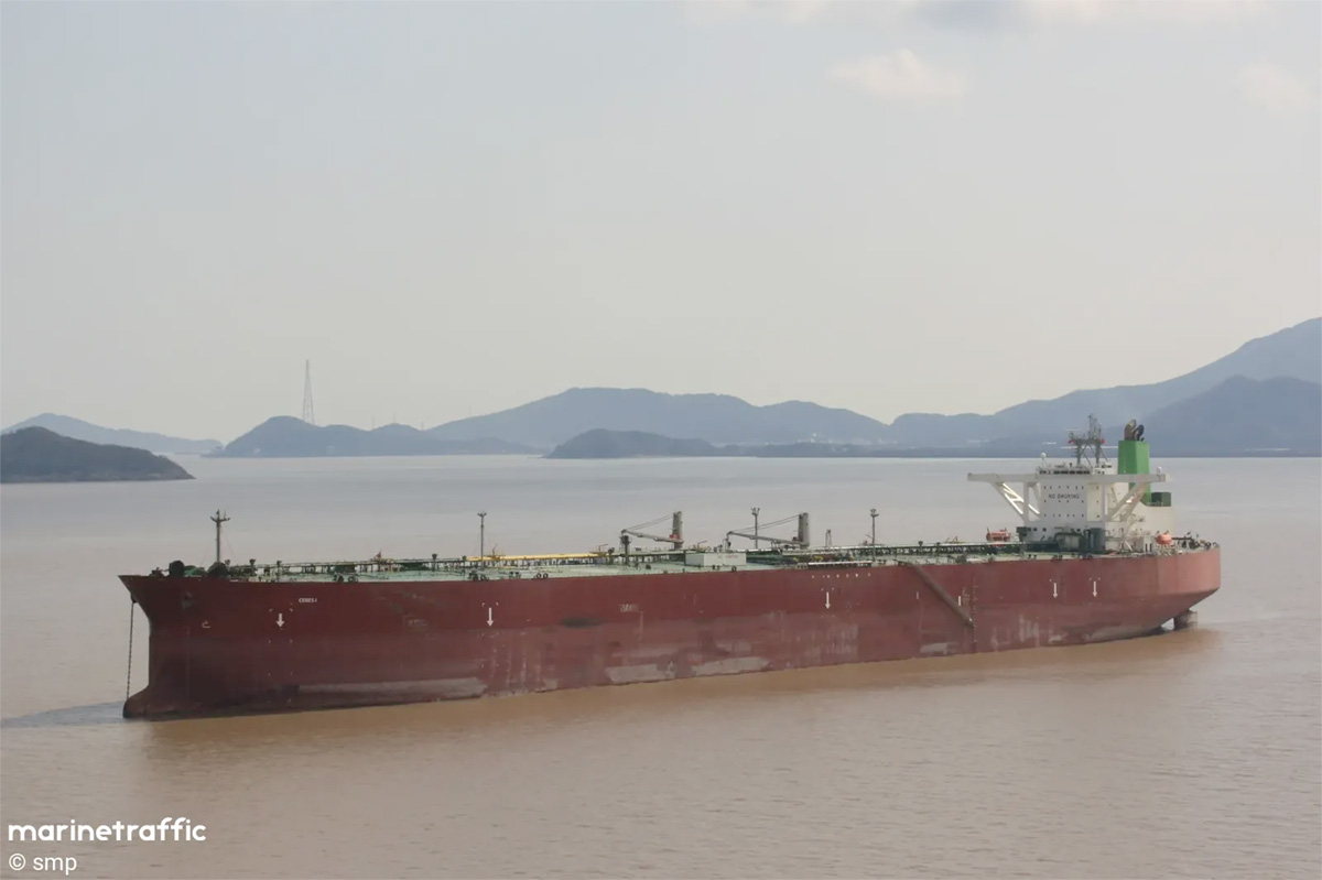
In the Strait of Hormuz and the Arabian Gulf, there is also a renewed increase in electronic faults that are affecting navigation systems. According to the multinational JMIC centre, there are increasing reports from the region around Bandar Abbas, a central Iranian naval base. The Automatic Identification System (AIS), which is used worldwide to transmit positions, is particularly affected. As a result, ships temporarily "disappear" from the screen and position data is inaccurate or completely blocked. The British United Kingdom Maritime Trade Operations (UKMTO) also reported a significant increase in such incidents on Monday. Technically, this is presumably GPS jamming or spoofing - methods in which signals are suppressed or manipulated. This can lead to considerable risks in busy sea areas, but comes as no surprise to experienced crews. No collisions have been reported to date, but shipping companies are talking about increasing uncertainty. AIS is considered indispensable in civilian shipping. Its impairment hinders communication and course guidance. This not only applies to large tankers that are difficult to manoeuvre, smaller ships are also dependent on reliable navigation data. According to JMIC, the origin of the interference signals is geolocalised, but there is no direct evidence of Iranian authorship to date.
Experienced skippers master the craft even without GPS and AIS
There is a lot of anxiety, but if the captains have learnt their trade and are also experienced, a failure of GPS and AIS should not automatically lead to chaos and collision. There are still nautical officers who can deal with other technical systems and also master the use of traditional communication systems. Whether a VHF radio, which is always available on board, is used or one is orientated towards terrestrial brands: A captain should be able to compensate for the failure of systems, otherwise he should not be trusted with an oil tanker. It is important not to rely solely on the technology, but to regularly check whether everything is plausible. Experts refer to this as "situation awareness". This means not only noticing dangers when it is too late. The good news is that you seem to have realised this in good time. Whether you draw the right conclusions is another question.
One thing is clear: this conflict is also a maritime one - with implications for our peace, prosperity and security. This is more than just the price at the petrol station or the margins for shipowners.
You can also read about threats to global trade here: https://marineforum.online/tag/maritime-choke-points/
Text: Schlüter
Sources: Spiegel, RD, Hansa
