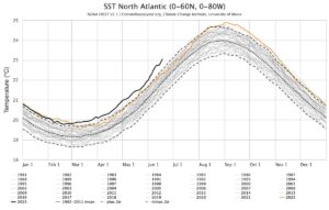
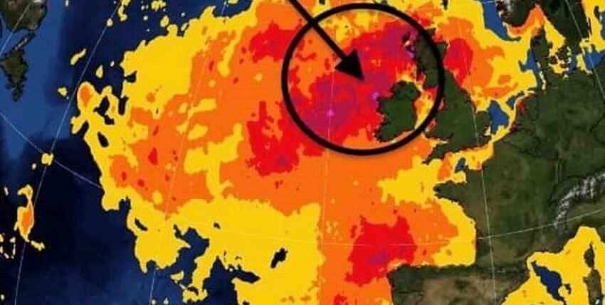
One of the world's most severe heatwaves is currently heating up the shallow seas around the UK. According to the US National Oceanic and Atmospheric Administration (NOAA), this is a category 4 out of 5 heatwave, a categorisation rarely used outside the tropics and meaning "extreme" heat. This is probably the result of relatively stable weather without Atlantic storms to mix the seawater.
Long-term records
The temperature of the sea surface has been recorded for over 20 years with the help of satellites and measuring buoys. In some sea areas of the United Kingdom and Ireland, the water temperature in mid-June 2023 is already 4 to 5 °C above normal. This is very unusual; it has never been so warm at the beginning of summer.
Ocean heat waves
Marine heatwaves (MHWs) have only been defined since 2016 as longer periods of unusually high sea surface temperatures compared to the long-term average for this time of year.
Oceanography
In the Southern North Sea, English Channel and Southern Irish Sea, surface temperatures are only around one degree above normal. In these shallow sea regions with water depths of only 30 to 40 metres and strong tidal currents, the water is well mixed from the surface to the seabed all year round.
The heatwave is strongest in the Northern North Sea, north-west of Ireland and the Celtic Sea between Cornwall and southern Ireland. These regions, with water depths of 80 to 100 metres and weak tidal currents, have little mixing. This means that these seas "stratify" in the current stable weather conditions in summer, i.e. a layer of warmer water overlies the cooler and deeper layer. In these seasonally stratified areas, the sun can therefore only heat the surface water, with the result that the nutrient-rich deep water no longer mixes with the upper layers.

Slow processes
In the highly mobile atmosphere, air temperatures can fluctuate greatly from day to day. In contrast, the more stable oceans have the ability to absorb heat slowly, but a lot, so that extreme temperature changes are rather rare.
The seasonally stratified regions described above regularly develop at the end of May - with peak values in August. The temperature there usually fluctuates by around 10 °C throughout the year. During the current heatwave, however, the sea surface is already up to 5 °C warmer than normal two months before the expected maximum temperatures. This situation will not remain without consequences!
Food chain at risk
The continental shelf around Great Britain and Ireland is one of the most biologically productive sea areas. They are an important fishing area for cod, haddock, mackerel and other species. These fish feed on smaller fish, crustaceans and krill, which in turn feed on plankton. However, plankton is dependent on nutrient-rich deep water. This year, the nutrient supply could therefore be lower due to the pronounced stratification and weaker mixing - and warmer water also contains less oxygen.
There is no doubt that climate change is also having an impact on the oceans. We are already seeing disruptions in the reproductive cycles of native fish species and plankton as their food source. Some previously unknown warm-water fish have already appeared in British waters. Such extreme heatwaves could therefore be harbingers of dramatic changes in the oceans. Marine biologists fear a significant reduction in the fish population in coastal regions if the recognised trend continues unchecked.
Source: CEST


